


As the autumn trees dropped their golden leaves and the winds turned to the south, we thought it might be time to do a triple Tassie island adventure before the southern tips of Australia started to freeze.
Happening Hobart
We had two overnight stops in Hobart in between our Maria and Bruny Island adventures and were surprised to discover how hip and happening Hobart had become. We enjoyed delicious meals at an old servo, drinks at a vinyl record bar and music at a Blues Jam!


The first Hobart night we stayed in Sandy Bay. Not expecting to find anything open on a Monday night for dinner, we were pleasantly surprised to stumble across In Good Company – a restaurant that had just opened in a former Sandy Bay petrol station and had quickly become Hobart’s hottest dining destination. It was packed and the menu read – and tasted – like our favourite Melbourne Asian fusion eatery Chin Chin. We devoured Miso broccoli, sticky pork belly, Kingfish ceviche – all washed down with a local blush Pinot Gris. The walk back to our accommodation along Sandy Bay was delightful too. The next morning, we clamoured up the hilly back streets of Sandy Bay to Giddy Up a cute suburban café that served decent eggs benny and coffee.
Our second Hobart stop was 3 nights later and we stayed down on the wharf at Customs house. We hiked up to the tiny wine bar called Sonny which specialises in boutique wines and vinyl tunes that thrum through some seriously good speakers. So good in fact that we visited the Pit and Giblin showroom the next day to meet Ross Giblin to find out more about these glorious sounding and looking speakers. After Sonny we went a few doors up to Grinners Dive bar for some Mexican street tacos (they make their own tortillas) and stayed for a Blues Jam that was seriously good! The next morning we grabbed a coffee at the delicious little Sun Bear coffee bar and buttery crispy croissants from Daci & Daci bakers.
Magical Maria Island
Our first ‘island of an island of an island’ adventure was the national park paradise Maria Island. We drove north from Hobart up the A3 through Sorrel then the increasingly little hamlets of Buckland and Orford to Triabunna where the ferry for Maria Island leaves. We stocked up on food at the IGA for our two nights on Maria Island, keeping our purchases, especially items that needed to be kept cold, to a minimum as there is no refrigeration on the island. There’s also only a basic camp kitchen that we were told had no cooking or eating utensils, so we had to bring our own saucepan, frypan, plates, cups, knives and forks. Oh, and water – Maria Island was in drought mode and had no drinking water or showers, so we had to pack 10 litres of drinking water too. Luckily Tasmania is the only place in Australia licensed to bottle drinkable rainwater!


The 40-minute ferry ride over was choppy but cheerful, and we soon saw the old silos at the Darlington Jetty come into view – along with the first of many of the old settlers’ huts and the convict probation station – which was to be our home for the next two nights. We hauled our packs on our bag and hiked 500m or so up the gravelly track – there are metal trolleys for transporting your gear, but dragging these up the gravel track looked like more effort to us than carrying our gear! We stored our packs in the laundry and headed off for the Painted Cliffs (4.5 km circuit) which are only accessible 2 hours either side of high tide – and the tide was turning.


We shared the gravel path down to Hopground beach with bike riders and paddymelons (the small stocky marsupials endemic to Tasmania that look like wallabies) walking past a few old settlers’ cottages perched on the cliffs or tucked into the bush. The tide was coming in on Hopground beach but there was still room to walk along the white sand to the ochre and limestone cliffs. It was early afternoon and I could only imagine how the cliffs would glow at sunset. We scrambled along the cliffs and soaked up the sandstone paintings marvelling at how the wind and waves had swirled shades of red, orange and yellow iron oxides to create abstract paintings along the cliffs.


We took the inland track back via Oust House the old Hop kiln built by the convicts in 1847 (I bet they never got to drink the beer made from the hops!) and then ‘checked in’ to our rom at the old penitentiary. There are ten rooms each with a set of three bunks with a hard vinyl mattress. Plus, a wooden picnic table and a Coonara fireplace (April – November only). Theres no electricity, no locks on the door and some have no windows. You can collect firewood from a woodpile back down towards the jetty, but you need to bring your own firelighters and matches. When you book a room, you pay for and get the whole room so at least we had the place to ourselves! We had a cup of tea in the mess hall – where we discovered there were kettles, a couple of mugs, pots and pans, electricity, power points for charging phones, and some display cases divulging stories of the flora and fauna on the island.


We headed off for a late afternoon walk to the Fossil Cliffs (4.5 km circuit) on the northeast on Fossil bay, walking past the ruins of the ‘twelve apostles’ a row of workers cottages along the road behind the mess hall then up Brickfields valley – a track leading up the grassy hill towards fossil cliffs. We looked up at Mt. Bishop and Clerk – our destination for tomorrow then turned down towards Cape Boullanger where the sun was heading towards the horizon and creating a lovely glow. We took the limestone path down to the Fossil Quarry where they used to mine the fossils to make cement in the early 20th century – but the area is now a protected heritage site as the cliffs are packed with fossilised remnants of 300-million-year-old marine life, such as corals, clams, and sea lilies. We walked home past the air strip, the cemetery and settled on the verandah of our bunkhouse for a cuppa as the last light faded from the sky.


We were hoping to have a BBQ for our dinner but the BBQs are a fair hike away down in the campground and as it was starting to drizzle we cooked our sausages in a frypan instead in the mess hall then headed back to our bunkroom, lit the fire and played cards by firelight.
After a particularly restless, sleepless night on the rock hard beds with no pillow we were up at dawn for a beautiful sunrise and then off on our hike up to Mt. Bishop and Clerk by 8am. This is a grade 4 12 km up and back hike that really should be grade 5 for the hour or more of rock scrambling it takes to get to the summit. There’s a few signs up top warning of the sheer drops and dangers of ascending in high winds so we climbed slowly up to the big boulders for some incredible views back over to Tasmania and out to sea. It was slower going down for me on my dodgy knees and I was glad I’d bought walking sticks.


We completed the walk by midday and as there were no other walks we could do from Darlington we decided to catch the afternoon ferry back to the mainland for showers and a soft bed half an hour up the road in Swansea.
Colourful Swansea
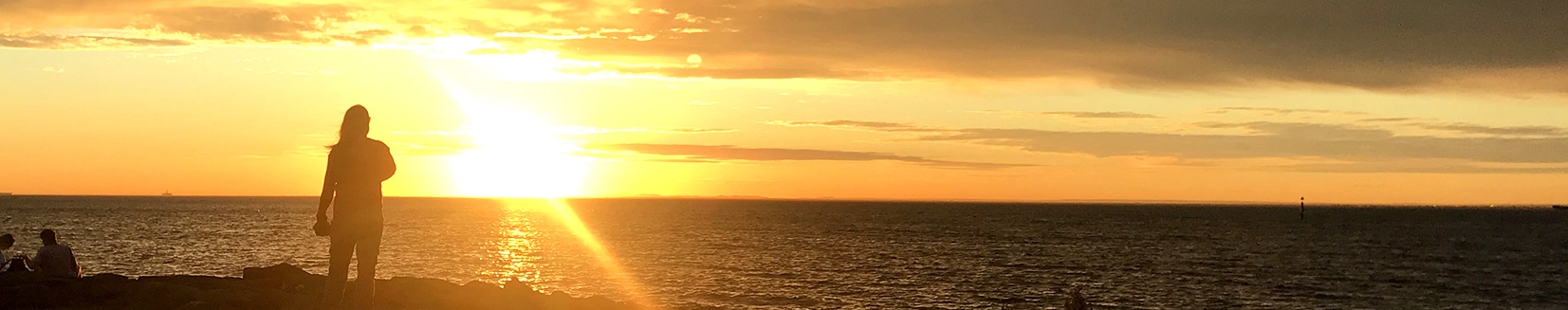
We got to the little seaside town of Swansea about 40 minutes north of Triabunna at sunset and enjoyed a stroll along Jubilee beach as the setting sun lit up the sky in mauve and rose. We headed for the RSL for dinner (along with the entire population of Swansea it seemed) and after paying our respects to the soldiers at 6pm tucked into beef cheeks on mash and fish and chips. As we crashed so early in our soft bed, we were up before sunrise and decided to do the 2.5 km loontitetermairrelehoiner circuit walk that gives you majestic views of the sunrise from the point past the golf course.


The walk starts from the boat ramp on Jetty rd., around the headland of waterloo point and down on to the rocky Schouten beach. We did yoga on the cliffs as the sun slowly rose over the ridge of the Freycinet Peninsula and Schouten Island and lit up Great Oyster Bay. The walk is named after the local band of Aboriginal people, who would gather clams and hunt the shearwater (muttonbird) that still come in their thousands to nest and breed in this area. Friday, we headed back down to Hobart, stopping off at 7-mile beach for a walk on this luxurious stretch of wild white sand close to the airport and Hobart suburbs. The wind was whipping the waves up and a storm was brewing so we scurried back to the car and headed for our second night in Hobart.
Beautiful Bruny Island
We drove 40 mins south of Hobart to Kettering for our ferry to our second ‘island off an island off an island’ – Bruny Island. We stayed in the car for the short 20-minute ferry ride as it was super windy and Seaspray was soaking the car. Our first stop on Bruny was north up to Dennes Point where we aimed to do the Dennes Point historic walk but we couldn’t find the carpark – so we just meandered around the gravel road admiring the fishermen’s cottages on the waters edge and the battered old cabins that looked like they’d weathered many a storm. Apart from a brewery that was closed it looked like there really wasn’t much at Denes Point so we headed back down through the centre of the island past Barnes Bay and Great Bay and stopped in at Isthmus Bay to climb up Trugannini Lookout at the neck. There was a severe marine wind warning with gusts up to 75 Km an hour and we were nearly blown off the steep wooden stairs on the way up. The view from the top was stupendous and the little sandy isthmus that keeps north and south Bruny joined looked extremely vulnerable in the whipping wind and waves.


We finally headed to our cottage for three nights at Alonnah, a little wary about staying in a ‘Treehouse’ in the severe winds (gusting to 75km/hr) but we were pleased to find it was pretty solid and we tucked up inside, lighting the Coonnara fireplace and weathered out the storm. The south westerly winds were pretty strong still the next day, so we drove down to Adventure Bay which faces east and had a gloriously quiet walk along Hansson’s beach admiring the way the sea had deposited bundles of kelp in artistic pictures along the sand. A little further on was the hamlet of Adventure Bay with a couple of shops, cafes and campground plus another lovely long white sheltered sand beach to walk along.


On our return to our Treehouse for lunch we lucked out with the baker delivering his load of sourdough loaves to the “Fridge” and bought a warm loaf and Anzacs (cash only $10 each). There were a few more cute produce and gift honesty fridges along the roadside and it warmed our hearts to see such trust in tourists to do the right thing and leave cash for goods. The winds abated in the afternoon so we walked from our treehouse down to sunset beach and along through the Sheoak woods to the Alonnah boat ramp where we saw a group of locals enjoying a beer at the ‘anglers club’ as the sun set over the bay.
Our last full day on Bruny was bliss. We woke to clear skies, no wind and were super excited to get down to Cloudy bay to do the east cloudy head hike. This 12 km return hike starts with a 3km walk along the wild wide beach and we wondered if the tide was coming in as we’d have to walk back the same way! The beach doubles as the access road for people going up to Cloudy corner campground and around the west corner is a great surf break at shallow bottom point with a viewing platform to watch the riders. There is no signage for the East Cloudy Head walk but Tas trails said to walk to the far end of the beach then turn up the river to the track. No signs at the ‘river’ outlet either but we bush bashed through overgrown marram gras and fallen trees and found the track and the sign in book. We made our way up through the cloudy corner campground (another way to access the walking track) and followed the rather overgrown narrow track through heavy bracken and shrubs. Jamie was getting increasingly nervous about the prospect of tiger snakes and not loving the closed in track so we decided to head back to the beach to enjoy the open sunshine and the waves. We spotted a number of roofs poking through the scrub along the walk back and discovered there are a few luxury homes for hire that I would definitely like to check out on our next visit to Bruny.


On our last day we went back to the neck beach for a windless walk along to Cape Queen Elizabeth. The waves were thumping and crawling further and further up the beach so we had to turn back a little before we got to the end but it was a glorious end to our four days on Bruny.
Tassie curiosities and observations:
“You’re right” is a ubiquitous term used to replace – Excuse me, Sorry, That’s Ok, yes that’s fine, Can I serve you?, Would you like something? Are you lost? That’s correct and thank you.
Pademelons (not to be confused with paddymelons the toxic weed from South Africa) are everywhere – sadly many squished along and on the roads. The name “pademelon” originates from the Dharug Aboriginal language word badimaliyan, used by the indigenous people of the Port Jackson area and means “small kangaroo from the forest”.
Water views – as Tasmania has 6,500 km of coastline it’s inevitable that almost everyone has a water view of some sort. Houses are strewn along the coast but also up the many hills ensuring the water is never out of sight
Drink the rainwater! Hobart rainwater comes in boxes! Tasmania is the only place that sells boxed or bottled, drinking-approved rainwater.


